The call, as it usually does, came at the worst possible time.
“The Virginia Department of Housing and Community Development contacted us on Jan. 4th, asking for our help,” said Brandon Herndon, director of the Center for Geospatial Information Technology (CGIT) “They wanted to use our map of broadband coverage throughout Virginia to challenge a national map that was being used to distribute $42 billion dollars of federal funds for broadband improvements.”
Their timeline? Ten days.
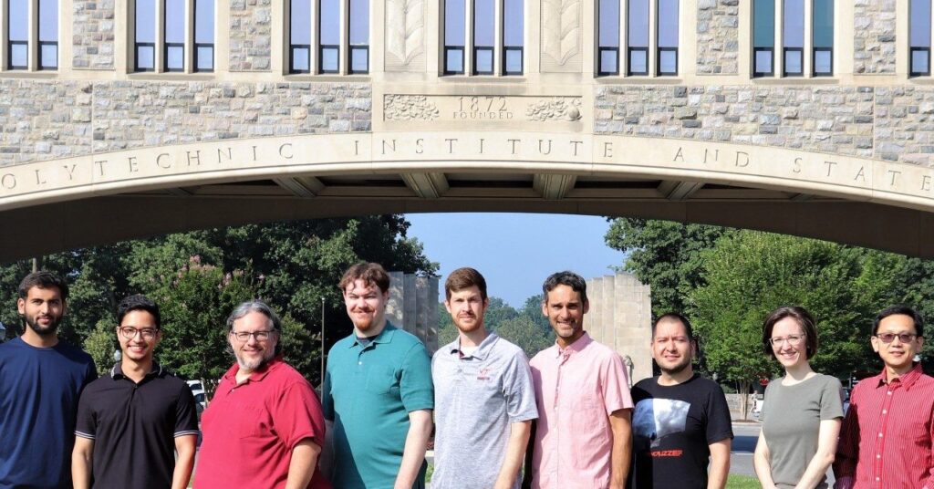
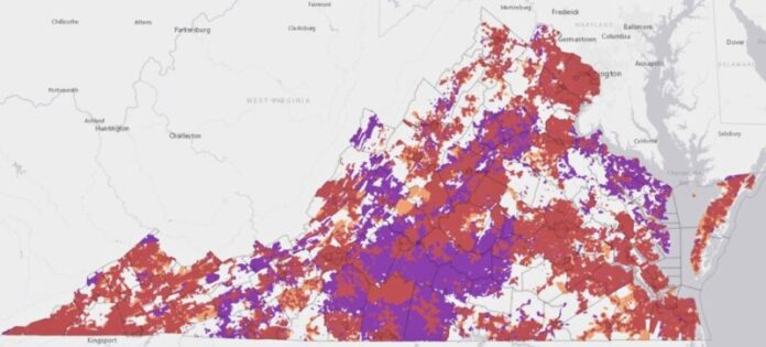
Shaking off the cobwebs from an abbreviated holiday break, Herndon’s team of research faculty in the College of Natural Resources and Environment went to work comparing its map of broadband access in the state — the Commonwealth Connection — to the national broadband map utilized by the Federal Communications Commission (FCC).
Six months later, the results of CGIT’s efforts came in: $1.4 billion in federal allocations to enhance broadband throughout the commonwealth, with representatives from the Virginia Department of Housing and Community Development estimating that CGIT’s challenge garnered approximately $250 million in additional funding.
Improvements in broadband infrastructure
The COVID pandemic put a national spotlight on the importance of broadband for working, going to school, and receiving health care and other services. The pandemic also revealed the gaps faced by many individuals and communities in accessing the high-speed internet that many Americans take for granted.
To enhance and improve broadband access in the country, the U.S. Senate committed $42 billion to the Broadband Equity, Access, and Deployment (BEAD) Program in 2021.
To determine which regions in the U.S. were underserved, the FCC utilized the Broadband Serviceable Location Fabric, a nationwide map of locations where fixed broadband service is — or could be — installed.
The CGIT team, situated in the Department of Geography, took a different approach to measuring broadband access in Virginia. Utilizing some 3.8 million specific address points, the CGIT team produced a consumer-accessible map that provides a granular depiction of broadband access.
“Although internet service providers were required to submit location-level coverage data, the FCC reporting deadlines resulted in many of them submitting simple coverage information based on census block reporting,” Herndon said. “This resulted in many locations showing as ‘served’ for broadband which were still lacking in coverage.”
These efforts align with the center’s mission to utilize geospatial science technologies to improve the quality of life, environment, and community through strategic partnerships with stakeholders and communities in the state.
“CGIT has been a leader in delivering geospatial expertise for many years at Virginia Tech,” said Professor Tom Crawford, chair of the Department of Geography. “Their work to identify and rectify gaps in broadband coverage in rural communities exemplifies our commitment to improving the economy and human well-being throughout Virginia.”

Aligning one map to another
With the FCC announcing the allocation of BEAD funds in early January, Herndon’s team had to figure out how to align CGIT’s map of broadband access in Virginia with the map that the FCC was utilizing. That alignment would allow the researchers to identify regions and locations to “challenge” on the FCC coverage map.
“What we had to do was connect all of the address points — 3.8 million address points — to the parcels identified by the FCC model,” said Herndon. “We were able to map each point and align them to a parcel where broadband service was located. We did the same thing with our addresses, and that gave us an apples-to-apples comparison of the two approaches.”
The CGIT team ended up challenging 180,000 parcel points, with the FCC conceding approximately 80,000 underserved locations. Those challenges resulted in a final allocation of $1.4 billion dollars of BEAD funding to Virginia.
Virginia Department of Housing and Community Development Director Tamarah Holmes said the contributions of CGIT were integral in increasing allocation dollars to the state.
“CGIT’s analysis of statewide broadband coverage gave us critical information we needed to more effectively challenge the national broadband map to accurately reflect unserved areas in Virginia and increase federal funding coming to the commonwealth,” said Holmes. “It’s impossible to pinpoint an exact number, but we estimate this partnership with CGIT led to an additional $250 million in funding to improve broadband access in the state.”
For the CGIT team, the task of working toward a better, more accurate map of broadband access in Virginia isn’t over.
“While the money has been allocated, there are still problems in the current FCC coverage map,” said Herndon. “Right now, we’re in the midst of coding, designing, and setting up a challenge portal that will allow nonprofits, internet service providers, local governments, and jurisdictions the chance to challenge remaining inaccuracies within the FCC coverage map. This is one last chance to make sure the places that need these funds to improve broadband will be able to access them.”
Once the challenge portal is created, the group will shift its focus toward enhancing the maps utilized by the FCC, so that national maps in the future will more accurately depict underserved areas of broadband access throughout the country.
Krista Timney


